The Flood Story
Floods in the Indian subcontinent have increased radically over the last few decades. It is imperative to understand the dynamics associated with this natural phenomenon in order to minimise its impact and come out with recommendations to be better prepared during the crisis. ‘The Flood Story’ is a comprehensive guide on the history of flooding globally and in India. It suggests ways for risk mitigation, especially for the most flood-prone regions in India and ways to prepare before, during, and after the deadly natural disaster to reduce loss of life and property.
CHAPTER 1
About Floods
About Floods
What is a flood?
A flood is an overflow of water that submerges land which is usually meant to be dry. While it may occur along river banks, lakes and sea coasts, river flooding is the most common of all around the world.
How are floods measured?
Floods are measured with the help of fixed measuring sites that are set up throughout the country; the National Weather Service gathers its data from these sources. These sites were established in locations with large populations or those with provisions that accentuate possibilities of flooding. For example, areas surrounded by or close to a confluence of two rivers would have greater possibility of getting hit by a flood than other regions.
The most commonly used tool to measure floods is the stilling well. This measures the height of a float in a hole dug alongside a water body. In order to maintain water level equilibrium in the subterranean chamber and the river, river water is connected through pipes to the gauge house, which is a cylindrical encasement embedded in a well. This allows to place the delicate reading and recording equipment right above the float.
There are other kinds of equipment that measure other aspects of a flood. A stream gauge, including the pressure transducer, calculates the depth of the water in a stilling well by measuring the pressure of the water column inside it. A bubbler gauge estimates the required pressure in order to send through air bubbles or nitrogen gas to the specified point submerged in the river. This transportation of bubbles is done via a thin tube placed above the ground gauge.
The weather service reports flooding in terms of the river crest height or “stage” for a particular site along the water. This value corresponds to the water level rise beyond the specified reference height, usually known as the “gauge 0 datum”. The baseline of one gauge location varies from another gauge locations. It shows the river bed elevation level which is measured in units of feet above the sea level. These stage measurements are then classified into various degrees of floods to determine the way forward with respect to dealing with a flood crisis. It is as per these recordings that decisions, like closing roads or evacuating residents from an area are taken. These categories range from the pre-flood action stage in order to prepare weather services to combat future flooding through minor, moderate and major flood stages.
The point at which water levels propose a risk to lives and livelihood varies from one place to another. Therefore, every area has its own flood stage water levels and list of tasks to be performed during a flood. This is the reason why measurements of floods of two different locations should not be compared against each other; they have no meaning.[1]
Why are floods dangerous?
Floods are the most common natural disasters in the world. While widespread devastation is caused during the time of floods, repercussions of flooding stay on for much longer even after there is no rise in water levels in an area. These include:
- Damaged utilities: floodwater can damage natural gas or electrical power. Therefore, to reduce possibilities of fire hazards, turn off these utilities, especially if you suspect odors or sparks during a flood. Switch on an electrical appliance only when there is no water and it is completely dry. For gas or electricity related problems, contact proper authorities to help with the appliance usage during a flood.
- Steer clear from dirty water: floodwater is likely to get mixed with garbage, sewage, debris and other hazardous substances like chemicals. Floodwater, if collected for a long time, can lead to outbreaks of communicable diseases and infections. It is vital to dry out houses and disinfect everyday utilities including clothes, utensils etc. as soon as possible after and during a flood.
- Be extra cautious while traveling: as per the Centers for Disease Control and Prevention (CDC) report, six inches of water can cause a person to lose control of a motor vehicle and two feet of water can carry most cars away during a flood.[2] Be extra careful while traveling during a flood.
- Be careful of mold infestations: people with higher sensitivity towards mold or those with chronic lung illnesses should look out for mold infestations after a flood. If not addresses in time, it can cause symptoms like lung infections, throat irritation, eye irritations etc. A thorough clean-up is vital after and during a flood.
- Safety comes first: never touch, walk over or drive through a fallen power line during a flood. Keep distance from overhead power lines. Call the power company to report fallen power lines and only workaround it under professional supervision or adult supervision, in case of children, during a flood.
Top 10 natural disasters:
- China Flood 1931: claimed between 1-4 million lives. This was followed by a two year long drought, catastrophic winter storms, rainy spring and summer seasons and unusually high cyclonic activity
- Yellow River Flood 1887: estimated lives lost approximately fall between 9,00,000 to 2 million lives
- Yellow River Flood 1938: claimed approximately 5,00,000 to 8,00,000 innocent lives
- Banqiao Dam Failure 1975: approximately 86,000 lives lost to the initial flood and nearly 1,40,000 lives lost to the following disease
- Yangtze River Flood 1935: over 1,40,000 lives lost
- St. Felix Flood 1530: claimed lives of over 1,00,000 people
- Red River and Hanoi Delta Flood 1971: nearly 1,00,000 lives lost
- Yangtze River Flood 1911: up to 1,00,000 people lost their lives
- St. Lucia’s Flood 1287: estimated loss of lives falls between 50,000-80,000
- North Sea Flood 1212: nearly 60,000 lives lost[3]
[1]https://slate.com/news-and-politics/2010/05/how-do-you-measure-a-flood.html
[2]https://www.accuweather.com/en/weather-news/5-dangers-to-be-aware-of-after-a-flood-strikes/70002092
CHAPTER 2
Causes of Floods
Causes of Floods
What are the causes of floods?
Heavy rains: unpredicted heavy rains can lead to increased water levels in rivers. While infrastructures like dams help to flow excessive water into appropriate channels like basins and reservoirs, heavy rains, however, lead to failure of such processes. This leads to a rise in water levels which then results in flooding of roads and houses. Such situations occur only when heavy rains are sustained for a long period of time.
Broken dams: old or poorly built dams do not have the capacity to hold collected water for long. They contain huge amounts of water which can travel up to ten kilometers at the time of an outbreak, causing mass destruction.
Poor drainage systems: poor drainage systems lack the ability to absorb water during heavy rains. As a result, these basins fill up and flood low-lying areas, especially in urban regions. These drainage systems are made of concrete which leaves no space for the water to sink into.
Lack of vegetation: widespread vegetation helps prevent flooding by slowing down the water runoff. While it is not necessary for such situations to always occur, lack of vegetation increases the chances of it.
Overflowing rivers: While dams help in controlling large amounts of rainfall and preventing floods, it may not be the case always since dam management and operation decisions are taken by government authorities. This can lead to increased water levels in rivers, which could then lead to a heavy overflow of water in residential areas.
Melting snow: the abrupt increase in temperature during winters can cause the ice and snow on mountain tops to melt. This melted snow drains into rivers and increases the water level. While this may not cause as much damage as heavy rainfall would, it could be disastrous depending on the situation.
CHAPTER 3
Types of Floods
Types of Floods
The Impact of floods can range from minor to major depending on the nature of the flood. The various types of floods include:
- Coastal flooding: coastal floods are caused as a result of extreme weather conditions. High tides causing a sea level rise can often result in this type of flooding. While low-lying areas are usually equipped to deal with such natural disasters, destruction caused due to coastal flooding can be more than imaginable. The 2018 Kerala floods were caused due to unusually heavy rainfall during the monsoon season. Over 120 deaths were reported and more than 1000 people were impacted by this deadly disaster.
- Flash flooding: flash floods are caused at the time of abrupt and heavy rainfall when the ground cannot absorb water at the same pace as it falls. While this type of flood does not take long to subside, its effects can be long lasting. Flash flooding can be prevented with good drainage systems. The 2012 Himalayan Flash Floods in India were triggered by an abrupt cloudburst, affecting northern states of Uttarakhand, Himachal Pradesh, Uttar Pradesh, and Jammu and Kashmir.
- Drain flooding: floods are not only caused by unfavorable weather conditions but also due to internal management failures. Drain flooding is caused as a result of blockage within the drainage system in an area. While sewer flooding can be internal i.e. within a building or locality, it could be external as well.
- Groundwater flooding: this type of floods takes time to occur since it can only happen over an extended period with continuous heavy rainfall. When this happens, the ground becomes saturated with water and fails to absorb any more water. This leads to an increase in groundwater level, resulting in water flowing above the surface of the ground. Groundwater flooding can last for several days, weeks or even months in some cases.
- River flooding: river flooding is the most common type of flooding in many parts of the world. It occurs when a water body exceeds its capacity to hold water and usually happens due to prolonged heavy rainfall. While river flooding results in a considerable amount of damage in nearby localities, it can be prevented if rivers are managed properly, especially in densely populated and flat areas.[4] In 2019, Maharashtra and Karnataka suffered great damage to life and property due to river flooding. River Warna and Krishna in Maharashtra and Dudhganga in Karnataka crossed their danger marks, resulting in devastating floods in the two states.
Damage due to floods depends on multiple factors including the duration for which floodwater remains before receding, the rate at which the water moves during the time of flooding, etc. It is vital to pay attention to roadways after a flood since excessive water can make roads weak and washed out. Similarly, it is also necessary to be cautious while entering buildings, since floods can weaken infrastructure support systems, increasing the chances for old and high rise buildings to collapse.
A flood may last for a few days, weeks or even months, depending on the nature of the flood. While they can occur at any point in time during the year, many usually occur seasonally. There are some common warning signs of such natural disasters that can help to prepare in advance to deal with such crises, if not prevent it completely. These include continuous heavy rainfall, slow moving tropical storms, and early snowmelt.
CHAPTER 4
Effects of Floods
Effects of Floods
Floods can be stressful physically, mentally, and emotionally. Starting from the anticipatory period before a flood to recovering and rebuilding after the flood, flooding affects people in multiple ways. It can cause heavy damage to property, disrupt families, destroy homes, generate sudden financial burden, and provoke long-lasting emotional trauma.
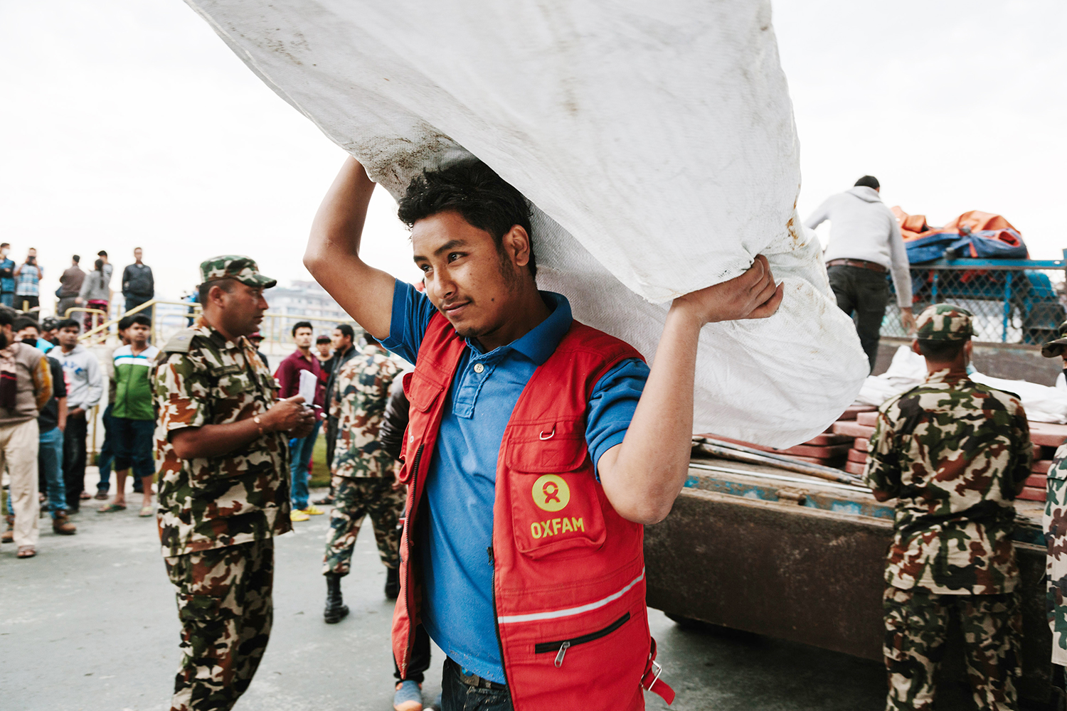
- Financial Burden: while some flood caused damages and losses are covered by insurance, others are not. Damages incurred due to natural disasters are usually not covered by insurance companies. It is important for landlords and property owners to check and enquire with their insurance agents about their plans and coverage for natural disasters. In some cases, state wise aid is offered by the government to flood affected people. There are also organizations like Oxfam India, Red Cross, etc. that provide humanitarian relief support during and after the crises.
- Physical loss: the effects of floods are destructive for the property. Floodwaters can disrupt vegetation by destroying land due to shoreline erosion and soil stripping. Heavy flowing water can damage natural vegetation at its roots. Flooding not only causes damage to property but also provides for hazardous living conditions after the disaster if floodwaters are not cleaned up promptly and properly. Floodwaters often carry in them dangerous objects like pieces of glass, metals, and nails, etc., which are injurious in nature. It can contaminate water supplies, damage drainage systems, and farm crops.

- Emotional trauma: experiencing a wide range of emotions, flood affected people often go through anxiety, fear, sadness, grief, and frustration during and after the disaster. Such conditions are often followed by symptoms like loss of sleep, loss of appetite, and mood swings. It is vital to counsel and provides immediate mental support to disaster-affected people to help them release their pain and recover from the trauma. Often, mental health professionals are sent to the disaster affected area to provide on-ground counselling to people, especially children.
No loss is big or small. But, the loss of life is the most heartbreaking experience natural disasters can inflict upon people. This can include loss of human life, pets, etc. Apart from this, effects of floods involve economic hardship which can take more than a while to recover from. It is caused by loss of farm crops, livestock and damage to food stores. Floods can severely impact tourism, leading to a dip in a region’s overall economy. This may even be irreparably damaged.
While floods are not pleasant for anyone, there are several positive environmental effects of flooding. Floods help in distributing large amounts of water and suspended river sediments across extensive areas, making agricultural land more fertile. This river sediment aids in replenishing valuable components of the top soil and keeps the landmass elevation above sea level.
CHAPTER 5
Floods in India
Floods in India
Climate change has led to a sudden significant rise in average global temperatures. While sometimes this results in no rain at all for long durations, at other times, it leads to abrupt bouts of excessively heavy rainfall. This has led to extreme weather events, especially in the form of floods in India, causing heavy damage to life, property and livestock. As per the Climate Change and India Report, temperatures in the Himalayan regions of India are projected to rise up to 2.6 degree Celsius and increase by 2-12 per cent in intensity by 2030, predicting more frequent episodes of flash floods in India. This can also result in large scale landslides, severely affecting agriculture and food security.
According to the Indian Meteorological Department (IMD), India in 2018 experienced the sixth lowest rainfall across the world since 1901. Additionally, it was also the sixth warmest year as compared to the last 100 years.
The 2019 monsoons in India were recorded to be the slowest progressing as compared to the last 12 years, according to the IMD.[5] A deficit of approximately 21 per cent was recorded till the month of August, with June experiencing the second lowest rainfall in the last seven years.[6] The last drastic rainfall deficit experienced by India was in 2014 with a 42 per cent deficit.
The global rainfall data recorded over the years draws an alarming picture. While the number of average rainy days are decreasing by the year, events of intense rainfall of 10-15 centimetre per day are radically increasing. This means that more water is pouring down in much lesser time as compared to previous years.
A study in the Nature Communications journal suggests that extreme events of rainfall in the Central India have been multiplied by three times over the last 66 years i.e. between 1950 and 2015. As per another study by the Indian Institute of Technology (IIT), Gandhinagar, extreme rainfall events are expected to increase in the Southern and Central India as a result of global warming.
Researchers at IIT used historical datasets of rainfall and temperature from nearly 7,000 meteorological stations of the Indian meteorological Department. They converted this information into grids of one-degree spatial resolution in order to analyse changes in yearly rainfall between 1979 and 2015. The findings of the study reflected an increase in many parts of India, except for the Indo-Gangetic Plains, Jammu and Kashmir, and North-eastern India. This decline in the Gangetic Plains is now being attributed to a reduction in the seasonal monsoon rainfall, which is in turn driven by increased atmospheric aerosols and warming of the Indian Ocean. Moreover, it also reflects a rise in precipitation levels in Southern India as compared to the northern regions from 1979 to 2015.
Besides shifts in precipitation levels, the study found out that the dew point temperature has also seen a drastic increase between 1979 and 2015. The dew point temperature is the temperature at which the air gets saturated with moisture. As global warming increases, water holding capacity of the atmosphere also increases. In India, the relationship between extreme precipitation and dew point temperature shows a rise of over 7 per cent per unit in many parts of the southern India.
The dew point temperature helps to accurately measure the atmospheric humidity, which largely affects extreme precipitation in tropical regions.[7]
“We find that in south and central India, precipitation extremes are more sensitive to warming than north India, which means that south and central India may witness more rainfall extremes in response to climate warming,” explained Vimal Mishra, head of the Water and Climate Lab at IIT-G who led the study, while speaking to India Science Wire.
Most flood prone areas in India
While coastal regions and river floodplains are most likely to experience floods in India, it is possible for other areas also to experience flooding. The major flood prone areas in India are Haryana, Punjab, parts of the Gangetic Plains including Uttar Pradesh, West Bengal, and North Bihar, the Brahmaputra Valley, coastal Andhra Pradesh and Odisha, and southern Gujarat.
The north Indian plains are more susceptible to floods as compared to the south Indian plains. Flood prone regions in India can be broadly divided into three categories:
- The Ganga Basin: mostly flooded in the northern India by northern tributaries of the Ganga River, it severely affects state like Bihar, West Bengal, and Uttar Pradesh. Besides the Ganga River, more rivere like Rapti, Gandak, Sarada, and Ghagra are likely to cause floods in Uttar Pradesh.Delhi and Haryana are usually flooded by the Yamuna River. Floods in Bihar are usually contributed by rivers like Burhi, Kamla, Gandak, and bagmati. In West Bengal, rivers like Damodar, Ajay, etc. largely constitute to flooding in the region, which often results in constricted river channels and tidal effects.
- Central India and Deccan River Basin: the deltaic area Odisha, formed by the Mahanadi, Brahmani, and Baitarni Rivers is densely populated. Often these rivers overflow their banks and cause flooding the nearby areas. Floods in the Southern and Central India are largely constituted by rivers like Godavari, Narmada, Krishna, Tapti, and Mahanadi.
- Brahmaputra and Barak Basins: the banks of the Brahmaputra and Barak Rivers get flooded due to excessive water in these basins. They also hold the potential to flood north-eastern states including Assam, West Bengal, and Sikkim. Flooding in states like Manipur, Sikkim, and West Bengal also results from overflowing water in the Jaldakha, Torsa, and Teesta Rivers.
76 per cent of the population in North Bihar live under a constant flood threat throughout most parts of the year. Besides Bihar, other most flood-affected areas in India include Uttar Pradesh, West Bengal, and states around the Ganga Basin. [8]
Top 15 worst floods in India over the last decade:
- 2018 Kerala Floods
- 2017 Mumbai Floods
- 2017 Gujarat Floods
- 2017 West Bengal Floods
- 2017 Bihar Floods
- 2017 Northeast India Floods
- 2016 Brahmaputra Floods
- 2015 Chennai Floods
- 2015 Gujarat Floods
- 2015 Assam Floods
- 2014 Kashmir Floods
- 2013 North India Floods
- 2012 Brahmaputra Floods
- 2008 Bihar Floods
- 2007 Bihar Floods
[5]https://www.downtoearth.org.in/news/water/storage-level-23-of-india-s-91-reservoirs-below-50--65214
[6] https://www.downtoearth.org.in/news/environment/this-june-may-be-second-most-rain-deficient-in-7-years-65321
[7]https://www.downtoearth.org.in/news/climate-change/extreme-rainfall-events-in-india-linked-to-emissions-study-60038
[8] http://www.geol-amu.org/notes/be1a-3-8.htm
CHAPTER 6
State Wise Floods in India
State Wise Floods in India
Assam Floods
Assam is hit by devastating floods almost every year. While rainfall patterns and the topography of the region contribute largely to the recurring floods, increased human intervention over the years has made it even worse. This includes unplanned urbanization, deforestation, the encroachment of river banks, etc.
The Brahmaputra River surrounds a large part of Assam, except for a few places. It is unstable due to steep slopes and high sedimentation. Assam falls in an earthquake-prone zone and heavy and prolonged rainfall every year.
According to the Assam State Disaster Management Authority (ASDMA), 2017 has been the worst in the last four years of floods. Assam floods in 2014 impacted over 1800 villages, displacing nearly 1.6 million people. In 2015, approximately 1.5 million people were displaced and over 1,000 villages affected. 2016 saw a drastic jump from 2015 with over 2500 villages affected and about 1.7 million being displaced.[10]
Effects of Assam floods
Assam experiences destructive floods every year. While in some cases, people find their way back to recovering from their physical loss, their emotional and mental trauma may be irreparable.
The flood situation in Assam has gone from bad to worse in the last few years. As of 2019, nearly 40% of the total land in the state has become severely flood prone due to yearly wear and tear of the region. Below given is the estimated damage caused by Assam floods from 1953 to 2016:
From 1953 to 2016, the estimated number of people affected annually, on average, totals up to 26 lakh, with the maximum damage being done in 2004 affecting 1.2 crore lives. The value of damage to home, on an average, is estimated at 7 crores annually, with the maximum damage done in 1988 at 103 crores. The loss of cattle, on average, estimates to about 10, 961 annually, with the maximum loss recorded in 2004 at 1, 18,772. The loss of lives due to Assam floods, on an average, approximately totals up to 47 annually, marking the highest record in 2004 with 497 deaths. The total damage including crops, houses and public utilities in the state, on average, adds up to 128 crores annually, with the maximum damage done in 2012 at 3200 crores.[11]
The state of Assam has experienced 12 catastrophic floods since 1950. While changes in the pattern of floods have been noticeable through the last one decade, prominent shifts in the frequency of floods have only occurred in the last few years. Assam floods have costed the lives of over 120 people in 2012, 42 in 2015, 28 in 2016, 85 in 2017 and 12 in 2018.[12]
Measures taken to control floods in Assam
In 1982, the Brahmaputra Board in its master plan suggested to build reservoirs and dams in order to mitigate floods. It proposed a multipurpose dam in Gerukamukh in Dhemaji, Assam, but the proposal was rejected due to objections from the Arunachal Pradesh Government; their concerns related to submergence of small towns.
The government has been using the single pronged approach of building embankments on the river to prevent floods. While these embankments were proposed years back as an interim or a short term measure only, they have stayed on for much longer than that. Moreover, these embankments are weak and regularly breached due to low investment in its building. Some of them were even built in the 1980s and have not been maintained since then. [13]
Possible long-term solutions to prevent floods in Assam
The problem of recurring floods in the state of Assam has not been addressed seriously by the central government. While floods cannot be completely avoided, certain preventive measures can be taken to reduce the damage. These include:
- Reconstruction of embankments
- Increasing forest cover
- Clearing drainage system in urban areas
- Wetlands rejuvenation
- Building more reservoirs to hold excessive water during the monsoon
- Planning and putting into action holistic rainwater harvesting plans
- Decentralized weather forecast
Assam Floods 2019
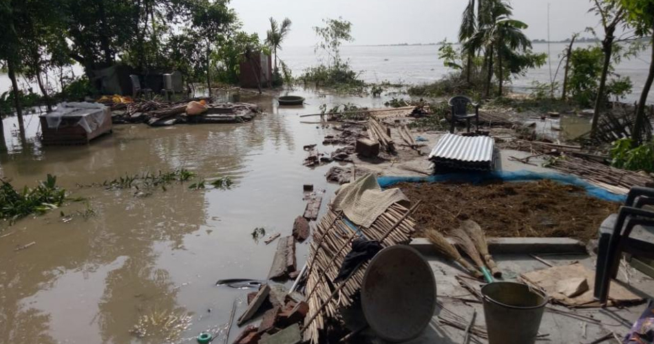
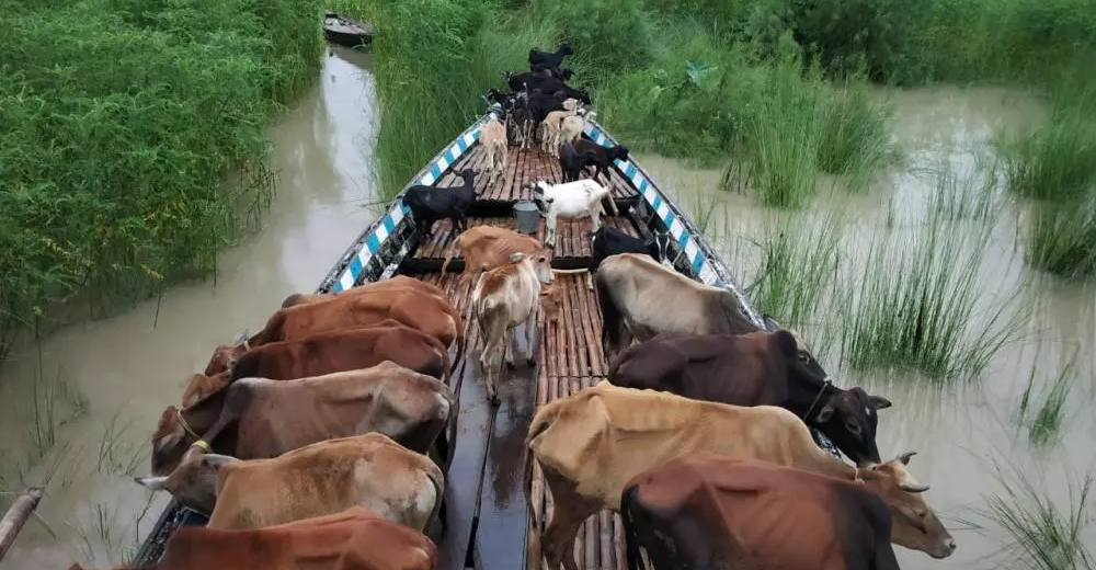
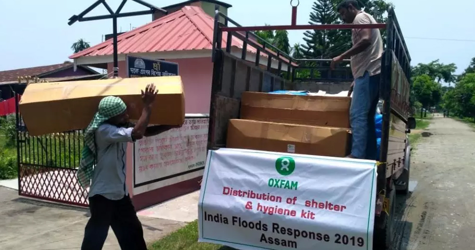
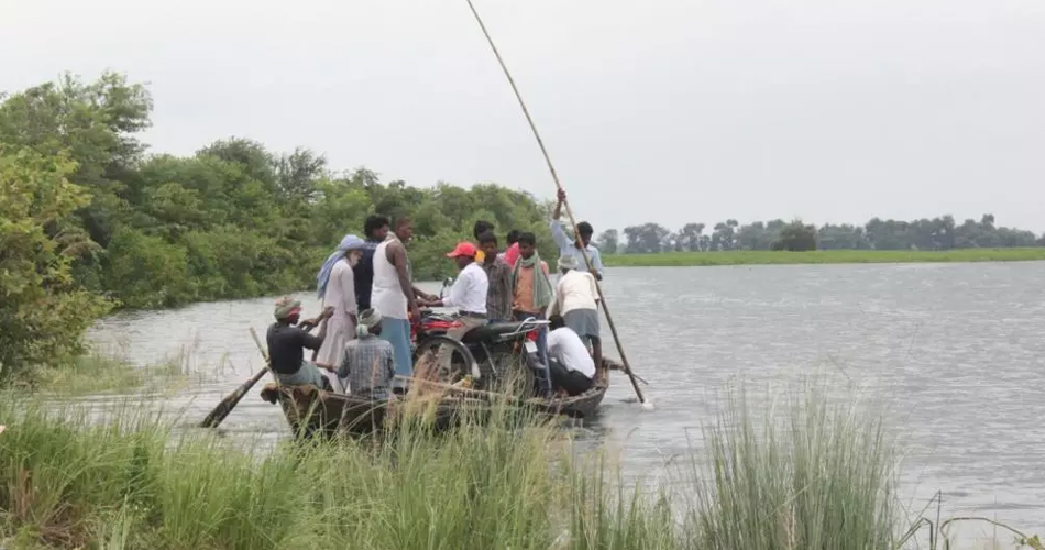
Continuous heavy rainfall has wreaked havoc in the state of Assam. More than 70 lakh lives have been affected and 90 dead in Assam due to the 2019 floods. Impacting over 4600 villages in more than 30 districts including Dhubri, South Salmara, Morigaon, Barpeta, Dhemaji and Lakhimpur, floods in Assam have caused irreparable damage in people’s lives. Nearly 2 lakh hectares of agricultural land, livestock and fish ponds have been destroyed, resulting in loss of livelihood. The Kaziranga National Park had submerged with about 10 lakh animals facing flood fury.
Oxfam India’s Response
Oxfam India along with its local partners has been tirelessly working in Lakhimpur, Dhemaji, Barpeta, Moregaon, Dhubri and South Salmara, providing flood relief support to affected people. We have provided emergency shelter and hygiene kits to 15,420 people, trained nearly 30,000 people on hygiene practices and installed 30 temporary toilets benefiting around 3,600 people. Additionally, 12 water filters were installed giving 2,664 men, women, and children access to safe drinking water. Nearly 20 hand pumps have been cleaned, 18 more installed, and 20 bathing cubicles have been constructed.
Click here to read more: https://www.oxfamindia.org/programdetails/1/humanitarian-response-and-drr
We need your support!
Support Oxfam India to help us reach out to more and more people in times of crises. Donate to Assam Relief Fund and help Oxfam India sustain its efforts of rehabilitating flood-affected people.
Click here to read more on Oxfam India’s work in Assam: https://www.oxfamindia.org/blog/oxfam-india-stands-flood-affected-families
Bihar Floods
76 per cent of the population in Bihar lives under a constant threat of flood destruction. Over 60,000 sq. km area in Bihar is highly prone to floods. Adjoined by Nepal, the Bihar plains are drained by several rivers including Kosi, Burhi Gandak, Bagmati, Balan, Kalma, Adhwara and Mahananda. Rivers originating from Nepal carry high discharge and sediment load which is dropped in the plains of Bihar.
Northern Bihar has recorded the maximum number of floods over the last 30 years. In 1978, 1987, 1998, 2004, and 2007, the state experienced some of the most devastating floods in the history of India.[14]
Bihar accounts for nearly half of India’s average flood loss in the country. While the state experiences destructive floods every year, the frequency and magnitude of these floods has gone from bad to worse over the last few years, facing extensive damage to life and property. Bihar witnessed the worst floods in 2008 affecting more than 30 lakh people in more than 1500 villages spread across 16 districts. The worst affected districts in the 2008 Bihar Floods included Saharsa, Supaul, Araria, and Madhepura.
Floods in Bihar are contributed largely by River Kosi, a major tributary of the Ganges. The Kosi River system drains large areas of the Eastern Nepal and Southern Tibet before entering Bihar. This river basin covers approximately half of the world’s significant peaks including India-Nepal Border, also known as the Sapt Kosi or Seven Rivers; the tributaries of the Sapt Kosi include Indrawati, Sunkosi, Lihku Khola, Tambakosi, Dudhkosi, Arun, and Tamur.[15]
What causes floods in Bihar?
Forests are being rapidly converted to agricultural land in Nepal over the past many years, contributing greatly to the increasing floods in India. From the 1950s to the 1980s, there was an annual increase in the run off in the Sapt Kosi and also in the rainfall in some stations of the basin. While the state government has built an embankments cover of nearly 3,000 km in Bihar, it not sufficient given that the river flow has multiplied by 2.5 times, resulting in the failure of these embankments during floods.
Possible long-term solutions to prevent floods in Bihar
While there is no permanent solution to stopping flood occurrence, some preventive measures can help in minimising flood damage. These include:
- Embankments: gaps in the existing embankments in Bihar reduce the effectiveness of these provisions. These should be repaired and maintained at regular intervals to ensure smooth and proper functioning.
- Detention basins: detention basins can absorb large amounts of water during floods. These should be repaired and upgraded as and when required.
Click here to read more on Bihar floods: https://www.oxfamindia.org/blog/making-communities-resilient-flood-prone-bihar
Bihar Floods 2019
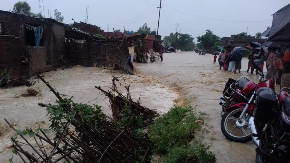
The 2019 Bihar Floods have impacted more than 80 lakh and killed approximately 130 people. Incessant rainfall resulted in floods in 13 districts of Bihar and displaced about 1 lakh people. The worst affected districts in Bihar include Sitamarhi, Sheohar, Madhubani, Araria, East Champaran, Kishanganj, Supaul, Darbhanga, Muzaffarpur, Saharsha, Katihar, and Purnia. According to the India Meteorological Department (IMD), North Bihar received record-high rainfall from 12-13 July 2019.
Oxfam India’s Response
Oxfam India did a needs assessment study in Bihar to identify long-term needs of flood victims. We chlorinated 487 hand pumps in the Sitamarhi district of Bihar, benefitting over 11,000 people. Nearly 5,000 people have been sensitised on child trafficking so far since possibilities of such episodes increase in times of crises.
Click here to read more: https://www.oxfamindia.org/floods-in-india
We need your support!
Support Oxfam India to help us reach out to more and more people in times of crises. Donate to Assam Relief Fund and help Oxfam India sustain its efforts of rehabilitating flood-affected people.
Kerala Floods
The state of Kerala does not experience floods as worse as the Indo-Gangetic Plains do but it is becoming more prone to flooding by the year. While Kerala floods largely occur as a result of incessant heavy rainfall, other factors that contribute to Kerala floods include mismanagement of water resources and forests. Human interventions including reclamation of wetlands and water bodies, construction and expansion of roadways, establishment of more and more settlements, deforestation, etc. have increased over the last few years in Kerala. It is estimated that 26% of the total geographical area of Kerala is prone to floods.[16]
What causes Kerala floods?
A report following the 2018 Kerala Floods suggested that neither the dams in the state have effective flood cushions, nor did they have proper flood control zone. Had the two been in place, the effects of floods could’ve been contained to a great extent.
Dams in Kerala lack Emergency Action Plan (EAPs), despite National Disaster Management Authority’s mandate to have it by 2009. The EAP is a written document which contains plans to prevent or lessen the effect of a failure of a dam. Most reservoirs usually get filled up even before extremely heavy rainfall hits the state. They lack the capacity to accommodate additional flow of water. This pushes the authorities to release large amounts of water from reservoirs in a short period of time at the peak of the rainfall. [17]
Kerala Floods 2019
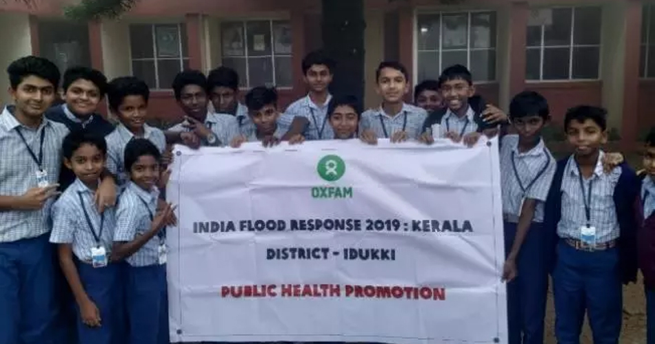
While Kerala was yet to recover from the 2018 flood loss, the state was hit by another round of devastating floods in 2019. It severely impacted nine districts in Kerala including Ernakulam, Idukki, Thrissur, Palakkad, Malappuram, Kozhikode, Kannur, Kasaragod, and Wayanad. More than 150 casualties were reported and over 30 people went missing as a result of the 2019 floods in Kerala.
The 2018 Kerala floods left the state more prone to natural disasters like earthquakes. There are 43 dams and reservoirs in the Western Ghats out of which, 21 are now highly susceptible to reservoir-induced (RIS) tremors or seismicity.[18]
Oxfam India’s Response
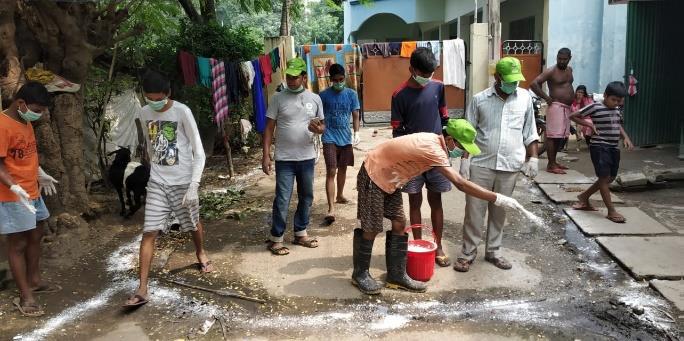
Oxfam India distributed dry food ration to nearly 150 most vulnerable families in Noolpuzha GP of the Wayanad district during Kerala floods 2019. 200 sanitary napkins and 2500 soaps were distributed amongst women and young girls to ensure their menstrual hygiene. Nine awareness sessions on menstrual hygiene management were conducted by Oxfam India during Kerala floods 2019 for more than 350 women and 45 girls at the school and community level in order to educate them about the importance of healthy and hygienic living.
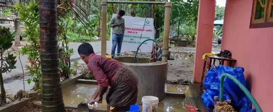
118 open wells were dewatered and chlorinated, benefitting over 1300 people in nearly 260 households. Awareness sessions on WASH practices were conducted in six schools, reaching out to nearly 600 children, to sensitise them on the importance of healthy living. Oxfam India organised village cleaning drives in more than 3700 households during Kerala floods 2019 as a preventive measure against spreading of diseases.
Click here to read more: https://www.oxfamindia.org/programdetails/1/humanitarian-response-and-drr
We need your support!
Support Oxfam India to help us reach out to more and more people in times of crises. Donate to Kerala Floods Relief Fund and help Oxfam India sustain its efforts of rehabilitating flood-affected people.
Maharashtra Floods
The major cause of flooding in Maharashtra is heavy rainfall that continues for a long period of time. While Maharashtra is not as prone to flooding as Assam, Bihar, and Kerala, it has experienced events of destructive floods in the past. In 2005, Mumbai received a record high rainfall of 84 centimetres (37 inches). This is the most rain a metro city with a population of over 10 million has experienced in a single day.[19]
The monsoon season in India brings with it moist, warm air from the Indian Ocean to coastal cities including Mumbai every year. The 2005 Mumbai Floods occurred exactly after a month of the 2005 Gujarat Floods. Floods in Mumbai lashed the metropolis on 26 July 2005, the day that brought the ever happening city of Mumbai to a standstill.
Maharashtra Floods 2019
The 2019 Maharashtra Floods affected more than 7 lakh people. More than 200 casualties were reported and over 1, 00,000 hectare agricultural land was severely damaged. Over 2 lakh households faced a severe shortage of electricity and water supply systems in approximately 400 villages was partially disrupted. Out of the many areas that were gravely impacted, Kolhapur and Sangli districts of Mumbai were hit the hardest, affecting more than 750 villages in 68 talukas of the two districts.
While heavy rainfall is a major reason behind Maharashtra floods, questions are also being raised about improper and ineffective flood management system in the state. Natural disasters like these are aggravated by water release from overflowing dams. Three of the biggest dams in Koyna, Radhanagari, and Warna regions of Maharashtra were already 100% full by the time floods hit the region. South Asia Network on Dams, Rivers and People (SANDRP) conducted a study of the Krishna River Basin to understand the root cause of the floods in 2019. The assessment showed mismanagement on releasing water from various dams, worsening the situation in Kolhapur, Sangli and Satara districts of Maharashtra.[20]
Oxfam India’s Response
Oxfam India conducted cleaning drives through eight villages of Sangli district, benefitting more than 5400 people. Hygiene kits were distributed in over 160 households in the Panchsheel Nagar Village of the Bhiwadi Gram Panchayat, Poluc Block, Sangli District. Three water supply systems were restored in Kohlapur and Sangli district of Maharashtra. This ensured access to safe drinking water for more than 22,000 flood-affected people.
Click here to read more: https://www.oxfamindia.org/programdetails/1/humanitarian-response-and-drr
We need your support!
Support Oxfam India to help us reach out to more and more people in times of crises. Donate to Maharashtra Relief Fund and help Oxfam India sustain its efforts of rehabilitating flood-affected people.
[9] walkthroughindia.com/walkthroughs/15-worst-ever-floods-in-india-over-last-decade/
[10] https://www.livemint.com/Politics/JEGERRSFHOVCAm86Pd1tnL/Why-Assam-faces-floods-every-year.html
[12] https://www.youthkiawaaz.com/2019/07/why-are-the-assam-floods-not-a-national-problem-for-india/
[17] https://www.independent.co.uk/news/world/asia/kerala-floods-latest-india-cause-flash-flooding-landslides-explained-a8500801.html
CHAPTER 7
Preventing Floods
Preventing Floods
Can floods be controlled?
Floods cannot be stopped completely but they can be prevented and effects of floods can be minimised. Some of the common methods of flood control include installing rock berms, sandbags, and rock rip-raps. Other ways of controlling floods include dikes, dams, levees, and retention or detention basins.
Below given is a list of seven measures to prevent flooding:
- Improved flood warning systems: effective flood warning systems can help take timely action during natural calamities and can save lives. Pre-planning can significantly reduce the effects of floods, give time for people to migrate to safer locations and stock up essential utility items for future.
- Building flood-resilient housing systems: concreting floors can be very useful during floods. Houses should be water proofed and electric sockets should be placed at higher levels up the walls to reduce chances of shocks.
- Constructing buildings above flood levels: buildings should be constructed a metre from the ground to prevent flood damage.
- Climate change: drastic climate changes have increased the frequency of natural disasters in many parts of the world. Governments should bring about environment-friendly policy level changes and eliminate the ones hazardous to the environment to tackle the problem of global warming. These can include limiting country-wise average temperatures at personal and industrial levels.
- Create wetlands and encourage reforestation: creating more and more wetlands can help soak up excessive moisture since wetlands act as sponges. Wooded areas can also slow down heavy water flow, minimising effects of floods. Often, wetlands are destroyed to make space for infrastructural development and agriculture. Reforesting upstream regions can significantly reduce the effects of flood damage.
- Improve soil conditions: improper soil management, animal hooves, and machinery can make soil compacted. As a result, instead of holding water in and absorbing moisture, the water runs off immediately. Properly drained soil can absorb large amounts of rainwater and can prevent it from flowing into the rivers.
- Installing flood barriers: these are flood gates designed to prevent the area behind the barrier from flooding. They can also be kept around buildings to keep floodwaters outside the boundary created. [21]
Floods: DOs and DONTs
DOs
- Turn off all gas and electrical appliances during a flood. Switch off these services at the mains to avoid accidents.
- Avoid direct contact with flood water. It can be contaminated with oils, chemicals, sharp objects, sewage and other harmful or unhealthy substances.
- Keep your emergency kit handy during a flood
- Keep your friends and family members informed of your every movement during a flood
- If you have to walk in standing water, make sure to use a walking stick or pole to ensure you do not step into deep water, manholes or ditches.
- Keep yourself updated during a flood. Listen to the radio or television for timely updates and important information or announcements.
- Stay away from power lines during a flood. Electric current can travel through water. Report and inform concerned authorities in case the power lines are broken and have fallen.
- Shut off electricity if the ceiling is wet. Place a bucket below the spot and poke a small hole into the ceiling to relieve the pressure.
- Use clean towels, buckets and mops to get rid of excessive water during a flood
- Place sheets of aluminium foil between wet carpets and furniture
DONTs
- Do not walk through floodwaters. The water current or flow can be deceptive and can be rather fast moving. It can knock you off your feet.
- Do not drive through a flooded region. It can make you miss your drop offs. Moreover, only half a meter of water can carry a car away. Driving through flood waters can also cause additional damage to nearby property.
- Do not swim through fast flowing water. It can sweep you away during a flood.
- Do not consume any food item that has come in contact with flood water
- Do not reconnect your power supply on your own and wait for a qualified engineer to do it for you during a flood
- Be alert for gas leaks during a flood. Do not smoke or use candles, lanterns, or open flames near it.
- Do not turn on ceiling fixtures if the ceiling is wet during a flood. Stay away from sagging ceilings.
- Do not use electric appliances like television, VCR, computers etc. while standing on wet floors, especially those made of concrete.
- Do not try to remove standing or collected flood waters with a vacuum cleaner
- Do not try and get rid of residual flood water in a basement too fast. It the pressure is relieved too soon, it may put undue stress on the walls.
Things to do after receiving a flood warning
- Try to be indoors when high tides and heavy rains occur simultaneously
- Do not litter plastic items or other waste material in the drain
- Monitor the weather forecast from time to time to know the status, potential magnitude and predictions of natural disasters
- Evacuate low lying areas and move to safer locations
- Make sure to keep your emergency kit handy. Your essential items list should have a lantern, torch, some edibles, dry clothes, drinking water and important documents while shifting or evacuating
- Place your valuables at a higher place in the house
CHAPTER 8
Oxfam India’s Humanitarian and Disaster Risk Reduction (DRR) Work
Oxfam India’s Humanitarian and Disaster Risk Reduction (DRR) Work
Oxfam India has been leading humanitarian responses for many years in India.
Oxfam India became an independent affiliate in 2008. Between 2008 and 2019, it has delivered more than 40 highly effective humanitarian responses across India and has reached out to over 1 million people in several direct and indirect ways. In 2015, Oxfam India responded outside of India for the first time during the Nepal Earthquake. Assistance by Oxfam India’s Humanitarian Team was provided in Gorkha district of Nepal, which was the epicentre of the earthquake.
Oxfam India follows a two-pronged approach during a crises- emergency response and long-term rehabilitation. Realising the need to support even after responding to the immediate needs during a crises, Oxfam India stays on ground to ensure complete survival, development, and recovery of disaster-affected communities. Oxfam India is recognised as a water, sanitation and hygiene (WASH) leader in the major networks across the country.
Oxfam India has closely worked with state governments to develop Standard Operating Procedures (SOPs) on floods, earthquakes, droughts, mass casualty management, and fires in hospitals. It has also contributed in Disaster Management Act 2005 review. Oxfam India was an active partner and core member of the drafting committee on DR Roadmap in Bihar. In Assam, it has played a major role in developing the state’s DRR roadmap.
Oxfam India reached out to over 25,000 most vulnerable households in 2018-19 across six states in India including Kerala, Bihar, Assam, Karnataka, Manipur, Odisha, and Tripura. Recovery and Disaster Risk Reduction (DRR) programmes were conducted in Assam, Bihar, Karnataka, Odisha, Kerala, and Uttar Pradesh to equip disaster-affected families with the skills to minimise the impact of floods and other natural disasters in future.
In 2019, Oxfam India responded to Cyclone Fani in Odisha. While immediate relief was provided to help cyclone victims recover from their short-term loss and trauma, long-term recovery programmes were also initiated and implemented in the state. While Oxfam India actively worked during the 2019 Assam and Bihar Floods, the humanitarian team also swung into action to monitor the deteriorating flood situation in parts of Karnataka, Kerala, and Maharashtra. Oxfam India along with their partners conducted a Rapid Needs Assessment (RNA) in the four worst flood-affected districts of Kerala. The team replicated this drill in parts of Maharashtra also with support from its local partner Sneha.
Oxfam India’s key focus areas during emergencies
Ensuring WASH facilities for all
A priority during all kinds of natural disasters, Oxfam India ensured better water, sanitation, and hygiene facilities for all disaster-victims. Below given are the reasons for the same:
- Water, Sanitation, and Hygiene (WASH) facilities are of tremendous concern in everyday life which get accentuated during an emergency.
- In a disaster situation lack of safe drinking water, safe sanitation, and hygiene practices can lead to serious health epidemics.
- Women, children, adolescent girls, and differently-abled people are the worst affected, who face WASH related challenges during and after disasters. Thus, ensuring access to these facilities is important.
Emergency Food Security and Vulnerable Livelihoods (EFSVL)
Oxfam India’s humanitarian work is divided into two stages- immediate emergency response and long-term rehabilitation and recovery. We believe in making communities disaster resilient other than addressing to their immediate needs. This is a very important part of humanitarian and disaster risk reduction (DRR) work because:
- Better nutrition for women and children from the worst affected families through dry food distribution to ensure their immediate survival is an important step towards ensuring their long-term survival.
- Provision of Unconditional Cash Transfer (UCT) for the worst-affected and most vulnerable households (Women headed households, Households with pregnant/lactating women, differently abled people and marginalised communities like Dalits) will help ensure their survival during the initial days of a natural disaster.
Gender balance during crisis
Women and children are the most vulnerable during natural disasters. This is the reason why focused attention should be given to addressing gender-specific needs during emergencies. Oxfam India conducts a gender analysis in every humanitarian project to understand the different needs of men and women. Oxfam’s Minimum Standards for Gender in Emergencies are used as tool to ensure a consistent approach to promote gender equality in humanitarian preparedness and response programming.
Click here to read about the importance of women during humanitarian emergencies: https://www.oxfamindia.org/blog/world-humanitarian-day-2019
Creating inclusive spaces for all
Oxfam India prioritises the inclusion of the most vulnerable and worst affected groups of people, especially those excluded from government benefits and other humanitarian organisations’ relief support. We encourage active participation of those differently-abled, people from socio-economically marginalised communities and women at every step of our intervention.
Disaster Response and Disaster Risk Reduction (DRR) initiatives
Oxfam India believes that the recovery phase during or after any natural calamity is the most important step before concluding a humanitarian project. It is the most effective method to achieve the larger goal of saving lives and livelihoods of people now and in the future. Oxfam India plans for a gradual shift from Humanitarian Response to Recovery and then to Disaster Risk Reduction through community capacity building to ensure the sustainability of the intervention.
Use of Information Communication Technology (ICT) based application to enhance the effectiveness of the humanitarian and DRR interventions.
- The effective use of technology ensures wider coverage with effective support to the disaster affected communities. Oxfam India Humanitarian App is used at various phases of the project to ensure effectiveness and appropriateness of the intervention.
Emphasis on ‘Localisation’ of humanitarian responses by larger participation of local communities at every level of the project.
- The humanitarian interventions by Oxfam India are always implemented through the local partners under supportive supervision from Oxfam Humanitarian Team.
- The major part of the resources is used for providing support to the communities and creating sustainable systems (capacity building of community on various aspects of disaster management, Task Force Groups, Linkage with government etc.) and structures at community level. [23]
- Training and capacity building of local partners and providing them with handholding support for planning and managing disaster response projects, including logistics and procurement activities act as a step towards sustainability of interventions at the community level.
Oxfam India’s work with partners
Oxfam India and its partner NGOs carry out inclusive community based interventions in the programme villages to enhance the levels of preparedness of the community to face disasters. The main areas of intervention includes capacity building and creation of village level institutions, as well as the below given:
- Training of village level committees on disaster planning and response including establishment of systems for early warning, search and rescue. Basic first aid and camp management.
- Supporting communities to prepare and undertake DRR activities as outlines in their Capacity Action Plans (CAPs).
- Preparation and circulation of Information Education and Communication (IEC) materials on critical areas ranging from first aid lifesaving skills, materials in a first aid kit, preparedness and alertness messages to search and rescue techniques.
- Strengthening the village level committees with search and rescue equipment including jackets, ropes, hammers, nails, mega phone, search/flash lights, etc. and basic support towards meeting place, visibility materials for the members and record keeping.
- Facilitating village level humanitarian response sub-committees to undertake periodic mock drills in coordination with other stakeholders.
- Supporting most vulnerable and active village committees with country boats for rescue, mobility, and for relief access during flood.
- Developing contacts with government line departments to facilitate linkage between CAPs and government schemes.
Click here to read more one Bihar 15 year roadmap to reduce risk of disasters: https://www.oxfamindia.org/featuredstories/bihar-designs-15-year-roadmap-reduce-risk-disaster
[22] https://ndma.gov.in/en/do-s-and-dont-s.html
[23] https://www.oxfamindia.org/blog/oxfam-indias-response-natural-disasters